
General Information
- See general fishing regulations for more information on how to use this summary.
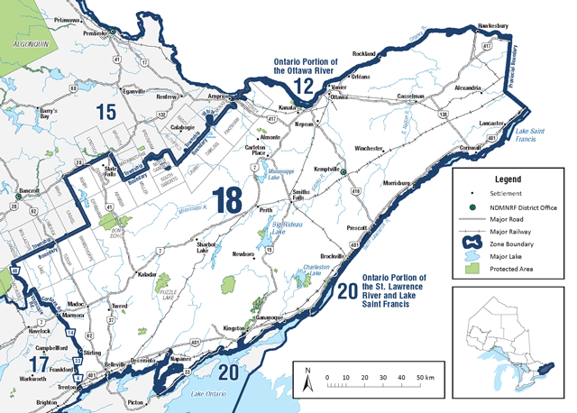
- FMZ 18 is part of the Southern Bait Management Zone (BMZ). Baitfish or leeches, whether live or dead, may not be transported into or out of a BMZ. See bait for more details.
Zone-wide seasons and limits
Zone-wide seasons and limits apply to all waters in the Zone except for the specific waters and species listed in the species exceptions and fish sanctuaries.
Aggregate limits for trout and salmon (including splake)
Limits: S-5 and C-2; total daily catch and possession limit for all trout and salmon species combined
| Species | Season | Limit |
| Atlantic Salmon | Closed | – |
| Brook Trout | All Year | S-5 and C-2 |
| Brown Trout | All Year | S-5 and C-2 |
| Channel Catfish | All Year | S-12 and C-6 |
| Crappie | All Year | S-30 and C-10 |
| Lake Sturgeon | Closed | – |
| Lake Trout | fourth Saturday in May to Sept 8 | S-2 and C-1 |
| Lake Whitefish | All Year | S-12 and C-6 |
| Largemouth and smallmouth bass combined | third Saturday in Jun to Dec 15 | S-6 and C-2 |
| Muskellunge | 1st Saturday in Jun to Dec 15 | S-1; must be greater than 91 centimetres, and C-0 |
| Northern Pike | Jan 1 to Mar 31 second Saturday in May to Dec 31 | S-6 and C-2 |
| Pacific Salmon | All Year | S-5 and C-2 |
| Rainbow Trout | All Year | S-5 and C-2 |
| Splake | All Year | S-5 and C-2 |
| Sunfish | All Year | S-300; only 30 may be greater than 18 cm, and C-15 |
| Walleye and Sauger combined | Jan 1 to Mar 1 second Saturday in May to Dec 31 | S-4 and C-2; must be between 40-50 cm |
| Yellow Perch | All year | S-50 and C-25 |
Species exceptions
Lake trout
Additional fishing opportunities
Season: open all year
- Ashden Lake (Ashby White Lake) (45°08′59″N., 77°22′00″W.) – Ashby Township
- Big Ohlmann (45°03′18″N., 77°00′23″W.) – Miller Township
- Camp Lake (45°04′54″N., 76°57′39″W.) – Miller Township
- Freen Lake (44°45′25″N., 77°44′53″W.) – Lake Township
- Grimsthorpe Lake (44°52′29″N., 77°23′29″W.) – Effingham Township
- Hungry Lake (44°48′23″N., 76°53′18″W.) – Central Frontenac Township
- Little Green Lake (44°57′37″N., 76°53′06″W.) – Clarendon Township
- Long Mallory Lake (44°59′59″N., 77°09′48″W.) – Abinger Township
- Long Schooner Lake (45°06′15″N., 76°58′41″W.) – Miller Township
- Loughborough Lake (44°27′00″N., 76°25′00″W.) – Pittsburgh Township
- Mackie Lake (45°04′38″N., 76°59′18″W.) – Miller Township
- Potspoon Lake (44°36′13″N., 76°34′56″W.) – Bedford Township
- Redhorse Lake (44°32′21″N., 76°05′02″W.) – Lansdowne Township
- Reid Lake (45°04′15″N., 76°55′59″W.) – Miller Township
- Round Schooner Lake (45°07′12″N., 76°59′14″W.) – Miller Township
- Shabomeka Lake (44°53′33″N., 77°08′10″W.) – Barrie Township
- Silver Lake (44°49′48″N., 76°35′46″W.) – Oso Township
- Simpson Lake (45°09′24″N., 77°24′13″W.) – Ashby Township
- Trout Lake (45°08′58″N., 77°26′08″W.) – Ashby Township
Muskellunge
Limits: S-1; must be greater than 102 centimetres, and C-0
- Moira Lake (44°29′14″N., 77°27′13″W.) – Huntingdon Township
- Moira River – from the first dam above Lake Ontario (City of Belleville) upstream to Highway 7
- Stoco Lake (44°28′15″N., 77°17′29″W.)
Limits: S-1; must be greater than 112 centimetres, and C-0
- Rideau River
Yellow perch
Season: January 1 to March 31 and second Saturday in May to December 31
- Lancaster and Charlottenburgh Townships (South Glengarry Township) and the City of Cornwall – all waters
Fish sanctuaries
No fishing – closed all year
- Big Rideau Lake – Bastard and Burgess Townships, The Bog and Long Island
- Newboro Lake – North Crosby and South Crosby Townships, Old Iron Mine Bay
- Newboro Lake – South Crosby Township, The Bog
- Opinicon Lake – Storrington Township, Darlings Bay
- Opinicon Lake – South Crosby Township, Murphy Bay
- Sand Lake – South Crosby Township, Freeman’s Bay
- Westport Pond – North Crosby Township
- White Lake – Olden Township
- Whitefish Lake – South Crosby Township, Jones Falls Bay
No fishing – January 1 to Friday before third Saturday in June and December 16 to December 31
- Lingham Lake – Grimsthorpe Township
- Sand Lake – North Crosby Township, that part lying in Lots 15 and 16 in Concession 9 and Lot 15 in Concession 8, and the waters of the river flowing between Wolfe Lake and Sand Lake
No fishing – March 1 to Friday before second Saturday in May
- Christie Lake – in Lot 3, Concession 3 (Bathurst Township) and the Tay River from Christie Lake downstream to the bridge at Lot 7, Concession 2 (Bathurst Township)
- Crotch Lake and Mississippi River – Palmerston Township, from Sidedam Rapids to north shore of Skull Island including McLean’s Bay
- Dalhousie Lake and Mississippi River – Dalhousie Township, within a 300 metres radius of the bridge of the Township road crossing the Mississippi River where it enters Dalhousie Lake
- Hoople Creek – Osnabruck Township
- Indian River and Clayton Lake – within a 300 metres radius of the Command Bridge crossing the Indian River where it enters Clayton Lake (Lanark Township)
- Mississippi River – Drummond Township, from 240.8 metres west of Main Street in Innisville to Mississippi Lake
- Mississippi River – Pakenham Township, between the falls in the Town of Almonte and upstream side of bridge on Lanark County Road 20
- Raisin River – those portions of the river in the Village of Martintown and Lot 43, Concession 1, north side of Raisin River (Charlottenburgh Township)
- South Nation River – Cambridge Township, Coupal’s dam in Casselman downstream to the westerly limit of Lot 11, Concession 5
- South Nation River – Hamlet of Crysler in Finch Township
- South Nation River – North Plantagenet Township, between north side of Concession 4 and a point 30.5 metres upstream of C.P.R. right-of-way
- South Nation River – Village of Chesterville in Winchester Township